This is just a very quick post to point out a Smartphone App I’ve been working on that allows citizen scientists, field rangers and landowners to map threats to and impacts on biodiversity. These include a range of impacts from invasive alien plants, plant mortality, landslides or illegal vegetation clearing, etc.
NOTE: Unfortunately, release of the app has been released due to location accuracy issues with the app development platform I’ve been using see this post for details. I hope to set it up on a different platform soon.
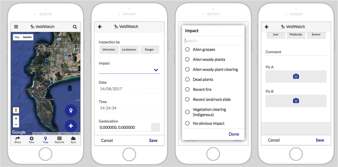
The App allows users to mark a specific GPS location, add notes and take images. It can work while offline, although a major snag (in addition to the accuracy issue) is caching the basemap information - because it obviously can’t download new map data once you’re out of signal.
I have been desperately trying to get this done fast, because a major short term aim was tracking the impacts of the current drought. In the long term, accumulating a database of records like these will be invaluable for any number of purposes. I hope to parse out alerts for the managers of different reserves etc and make the database (excluding any sensitive information) freely accessible. There is also scope to add functionality for specific projects.
If you are interested in being kept in the loop regarding the development and release of the VeldWatch Smartphone App. Please sign up on this Google Form and I’ll send an alert when more progress is made. Otherwise follow the RSS feed for this post.