2 Why care about GIS?
How lost would you be without Google Maps?
 for Cape Town.](img/googlemaps.jpg)
Figure 2.1: Screenshot of Google Maps for Cape Town.
If we search “Geographic Information Systems OR GIS” in Web of Science, it is clear that the number of papers using GIS has exploded over time!
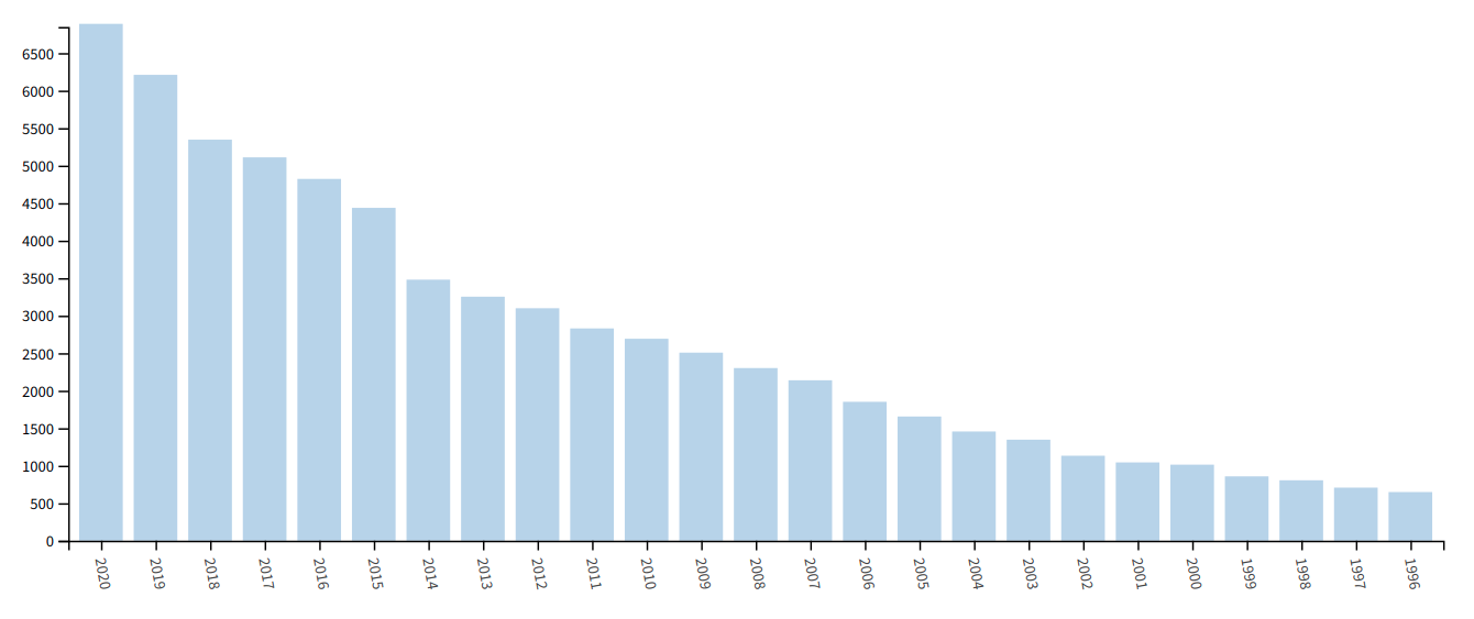
Figure 2.2: The number of papers on Web of Science when searching Geographic Information Systems OR GIS.
GIS is especially important in environment and life sciences!
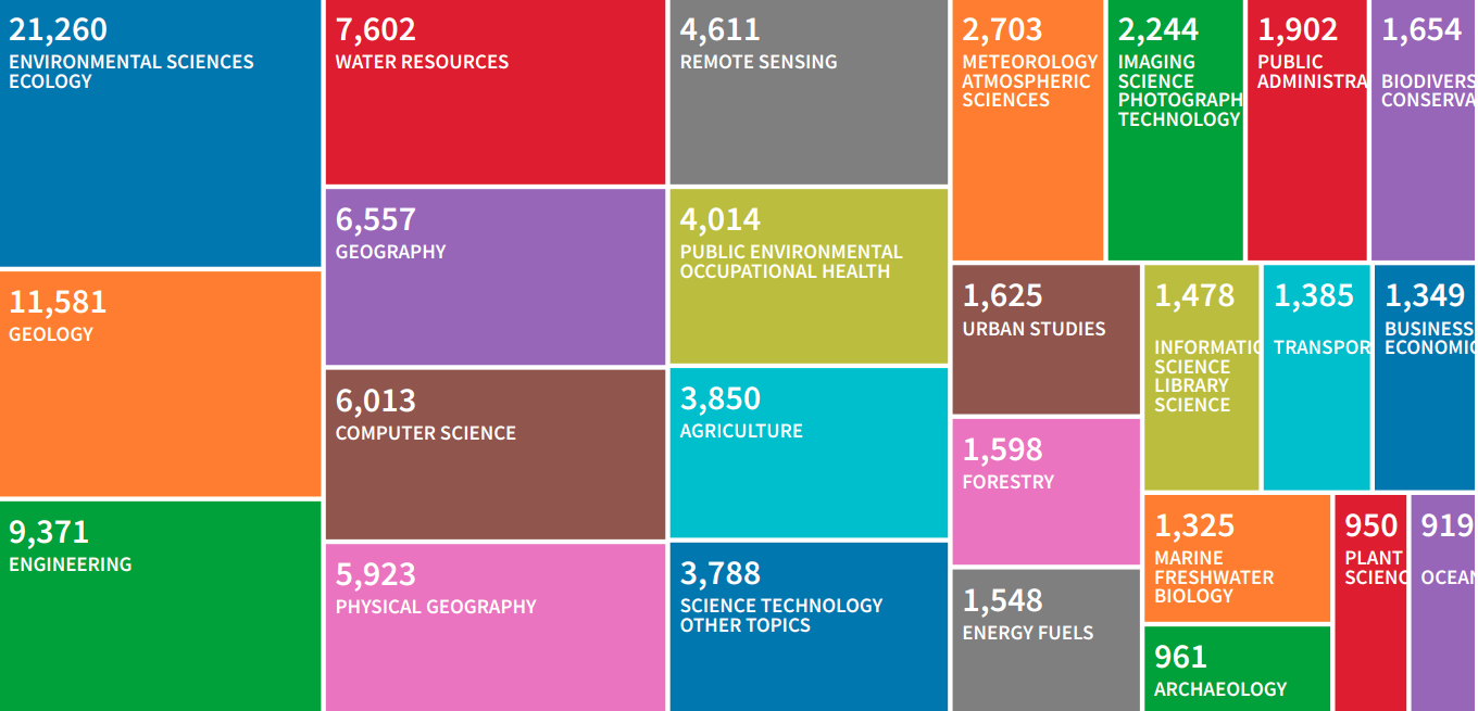
Figure 2.3: The number of papers on Web of Science by theme when searching Geographic Information Systems OR GIS.
We use it for things like mapping ecosystems and biomes.
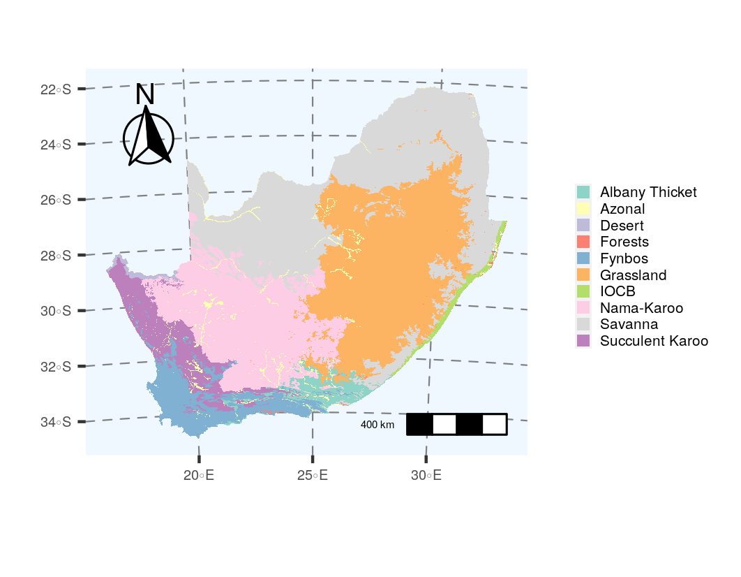
Figure 2.4: The historical extent of the biomes of South Africa from Mucina, Rutherford, and Others (2006).
Or the loss of ecosystems and biomes.
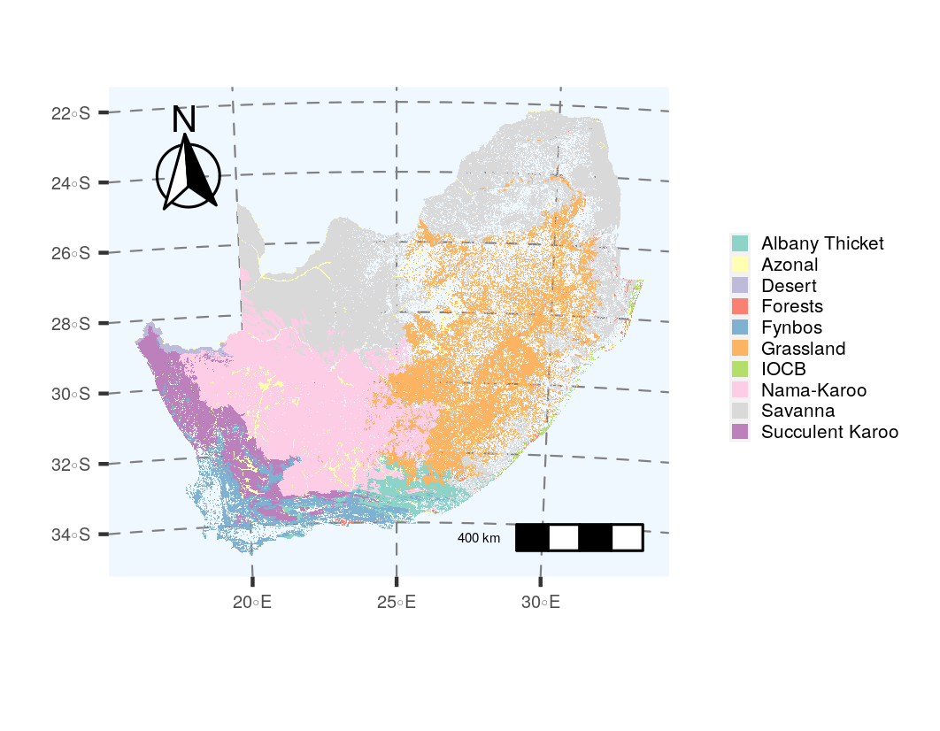
Figure 2.5: The remaining extent of the biomes of South Africa from Skowno, Jewitt, and Slingsby (2021).
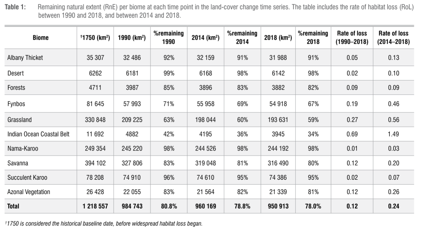
Although the outcomes of GIS analyses are not always maps, e.g. this table from Skowno, Jewitt, and Slingsby (2021).
But it can also be interactive!
Figure 2.6: The Global Forest Watch app.